
For Tigers, the Buffer Matters: Protecting Private Forests in Western India
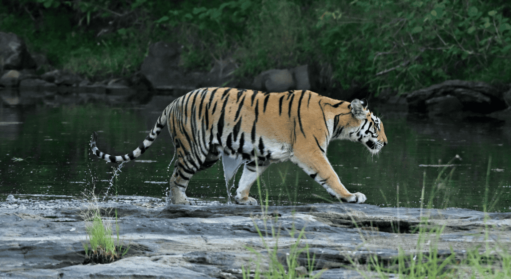
Protected Areas are essential for safeguarding wildlife, but the forests surrounding them are important, too. In western India, privately owned forests outside Protected Areas provide important habitat and allow wildlife to move through the wider landscape. Conservation Allies’ only partner in India, Applied Environmental Research Foundation (AERF), has spent nearly two decades working to protect these forests. Since 2007, AERF has worked with landowners and communities to conserve privately owned forests around Protected Areas such as the Sahyadri Tiger Reserve. Through its Myforest initiative, AERF developed India’s first incentive-based private forest conservation program, helping landowners keep these forests intact. Today, much of the surrounding forest remains privately owned, leaving important habitat vulnerable to development and other pressures. AERF identifies forests facing the greatest threats and works with landowners, local communities, organizations, and scientists to develop conservation agreements that protect these forests while taking local needs into account. To date, AERF has brought more than 15,000 acres of private forest under long-term protection, including around 5,000 acres surrounding important Protected Areas and wildlife corridors. Recently, AERF’s field team spotted an Endangered Bengal tiger in one of the forests it has long worked to protect. The sighting is an encouraging sign that these forests continue to provide habitat for at-risk wildlife and help maintain connectivity across the landscape. For AERF, the sighting points to a healthier, more resilient landscape. It is not simply evidence that a tiger passed through. It is a reminder of why the less visible work of protecting habitat around Protected Areas matters.
A New Base for Protecting 100,000 Acres of Forest in Peru
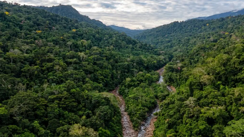
A new milestone for forest conservation has been reached in Peru with the construction of the first ranger patrol station in the Gran Simacache Conservation Concession, by our partner Neotropical Primate Conservation Peru (NPC) with the support of Conservation Allies. The new ranger station is the first of four stations planned under the joint action plan developed by NPC, the Asociación de Agricultores para la Conservación de los Bosques Naturales del Simacache, and the community of Nuevo Chimbote. Together, these partners are strengthening the local capacity needed to protect one of the region’s last remaining strongholds of intact forest. Covering almost 100,000 acres, Gran Simacache is an important refuge for biodiversity in the San Martín region. But its remote location and growing pressures—including land encroachment, illegal activities, and hunting—make effective protection increasingly challenging. Reaching this remote area currently requires an arduous journey of 8 to 12 hours on foot, making effective monitoring and rapid response challenging. The new ranger station changes that, by providing a permanent presence within the forest. With the capacity to accommodate 10 people, the facility will soon be powered by solar energy and equipped with satellite internet, creating a vital operational hub in an otherwise isolated region. The importance of this investment is already evident in the extraordinary wildlife found within the concession. Recent field visits revealed an abundance of animal tracks, highlighting the ecological significance of the forest. Particularly notable were signs of jaguars, tapirs, deer, and wild pigs—species that depend on large, intact habitats and serve as indicators of a healthy ecosystem. By establishing a permanent presence on the ground, the new station will help safeguard these forests and the wildlife they support while strengthening community-led conservation efforts.
A New Generation of Gorillas
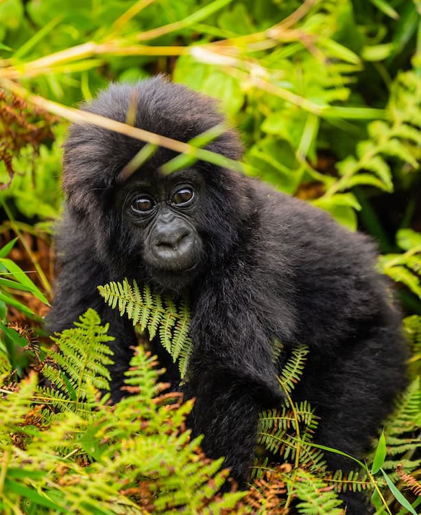
Last week, Rwanda celebrated a new generation of mountain gorillas at Kwita Izina, the country’s annual gorilla naming ceremony. Held in Kinigi at the foothills of Volcanoes National Park, the 21st edition of the event brought together communities, conservationists, researchers, and visitors to celebrate 22 newborn gorillas and the conservation efforts that make their future possible. Since the tradition began in 2005, 460 mountain gorillas have been named through Kwita Izina. Ishakwe‘Determination’Female · Muhoza family · born 1 April 2025Named by H.E. Shaikha Al Nowais Komezutsinde‘Keep winning’Male · Mutobo family · born 19 June 2025Named by Dominique Laura Plewes Mukondo‘Starting point’Male · Izuba family · born 20 June 2025Named by Dominic Barton Tarama‘To come together’Male · Humura family · born 21 July 2025Named by Mutaz Essa Barshim Bukaka‘Majesty, strength and power’Female · Humura family · born 28 July 2025Named by Marie-Clémentine Dusabejambo Inkera‘Traditional celebration’Male · Pablo family · born 31 July 2025Named by Miguel Ángel Gil Marín Impeta‘Symbol of recognition’Male · Izuba family · born 9 August 2025Named by Israel Mbonyi Rugamba‘Fighter’Male · Hirwa family · born 8 September 2025Named by Sadek Elsewedy and Anita Dravec Ndongozi‘Leader’Male · Musilikale family · born 26 September 2025Named by James Chester Muhuza‘One who brings together’Male · Kwisanga family · born 8 October 2025Named by David Lappartient Mpinga‘On the top’Female · Pablo family · born 11 November 2025Named by Alastair Fothergill Ngabonzima‘Protector’Male · Segasira family · born 28 December 2025Named by Garreth and Nicola Wood Igeno‘Destiny’Female · Musilikale family · born 15 March 2026Named by Kelly O’Meara Muganura‘Harvest and thanksgiving’Male · Izuba family · born 20 March 2026Named by Patrice Evra Ngoga‘Brave’Male · Kwitonda family · born 21 March 2026Named by Francesco Calvo Photos: Kwita Izina / Rwanda Development Board For the Mountain gorillas of the Virunga landscape, every new birth is worth celebrating. The species is Critically Endangered, with the most recent full census estimating 1,063 Mountain gorillas across their remaining range in Rwanda, Uganda, and the Democratic Republic of the Congo. Their recovery from fewer than 400 individuals in the early 1980s is one of conservation’s more hopeful stories, but their future still depends on protecting a small population and the limited habitat on which it relies. That is where the work surrounding Volcanoes National Park becomes so important. Conservation here is not only about protecting gorillas inside the forest. It also means working with the people who live alongside the park, reducing conflict between people and wildlife, restoring habitat, and creating opportunities for communities to benefit from conservation. For new Conservation Allies partner SACOLA (The Sabyinyo Community Livelihood Association), that connection between people and nature is at the heart of its work. Founded in 2004 by communities living around Volcanoes National Park, SACOLA works to conserve the park and its Mountain gorillas while supporting sustainable livelihoods for neighboring communities. SACOLA’s work has included community tourism, livelihood initiatives, and partnerships that channel tourism benefits toward local communities. Today, SACOLA is also supporting conservation directly on the landscape. Its initiatives include restoring gorilla habitat through the planting of 100,000 indigenous trees, maintaining and rehabilitating the buffalo wall along the park boundary to help reduce human-wildlife conflict, and engaging women and young people as Community Eco-Guards. Together, these efforts reflect an important principle: protecting wildlife and supporting the people who live alongside it are not separate goals. The naming ceremony is a celebration, but its deeper meaning reaches beyond a single day. A baby gorilla represents a future that conservationists, communities, and park staff are working to protect. Every healthy birth is a reminder of what sustained conservation can make possible—and of the responsibility to ensure these young gorillas inherit a forest where they can grow, form families, and thrive. As Rwanda celebrates another generation of Mountain gorillas today, Kwita Izina is an opportunity not only to celebrate their arrival, but to recognize the people and conservation efforts helping make that future possible. Support SACOLA SACOLA is restoring Mountain gorilla habitat around Volcanoes National Park—planting 100,000 indigenous trees, rehabilitating the buffalo wall that reduces conflict between wildlife and neighboring farms, and equipping community members as eco-guards along the park boundary. Mountain gorillas are Critically Endangered, and protecting a population this small depends on exactly this kind of work at the forest edge, where gorilla habitat meets farms and villages. 100% of all donations go straight to conservation.Donate to gorilla conservation
Inside the Work of a Ranger
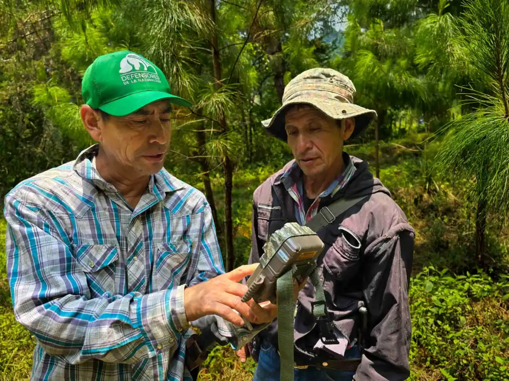
Every day, rangers patrol Protected Areas, help enforce conservation laws, and gather the information needed to guide management decisions and protect wildlife over the long term. The work is demanding. Rangers navigate difficult terrain in remote areas, often with limited resources, and in many places they face real risks while responding to illegal logging, poaching, and wildlife trafficking. And they depend on professional support: training, equipment, and funding. Much of this work happens out of public view, but it is the foundation of effective Protected Area management. When Life Experience Meets Science One recent example from Guatemala highlights just how valuable a ranger’s experience can be. Earlier this year, Conservation Allies partner Defensores de la Naturaleza confirmed the presence of jaguars and pumas in the Sierra de las Minas Biosphere Reserve through camera traps, which. provided the scientific evidence needed to formally document their presence. The monitoring effort relied on more than technology. It depended on the experience of park ranger Óscar Hernández, who has known the Sierra de las Minas since childhood. His understanding of the landscape—where wildlife travels, how animals move through steep mountain terrain, and which natural corridors they use—determined where the camera traps should be placed. The results confirmed what rangers had long understood. Camera traps captured multiple independent records of pumas, along with images of both a male and female jaguar. The findings also reinforced the importance of combining monitoring with local knowledge. Many Roles, One Purpose Half a world away, Hasina Eric Randriambololona has spent over a decade doing work that rarely makes headlines, but keeps a forest standing. Since 2012, he has served as a ranger at Manjakatompo Ankaratra, a Protected Area in Madagascar’s central highlands working with Association Natiora and with support from Conservation Allies. Hasina patrols the Protected Area and collects field data on the forest and species, and, when fire season arrives, works with crews around the clock day and night to keep fires from entering the Protected Area. In Madagascar alone, rangers supported by Conservation Allies partners protect 91 Protected Areas, covering tens of thousands of miles of patrols annually through some of the world’s most unique and threatened ecosystems. Across our global partner network, rangers helped protect more than 15 million acres of critical habitat in 2025 alone. Whether patrolling Madagascar’s highland forests or documenting jaguars in Guatemala’s mountains, rangers provide the knowledge and long-term presence that conservation depends on. Their work often happens out of public view, but it is essential to protecting wildlife, maintaining healthy ecosystems, and ensuring Protected Areas continue to safeguard biodiversity for generations to come. Global conservation targets depend on that work—and on continuing to invest in the people who do it.
Entering a New Era of Conservation in Madagascar
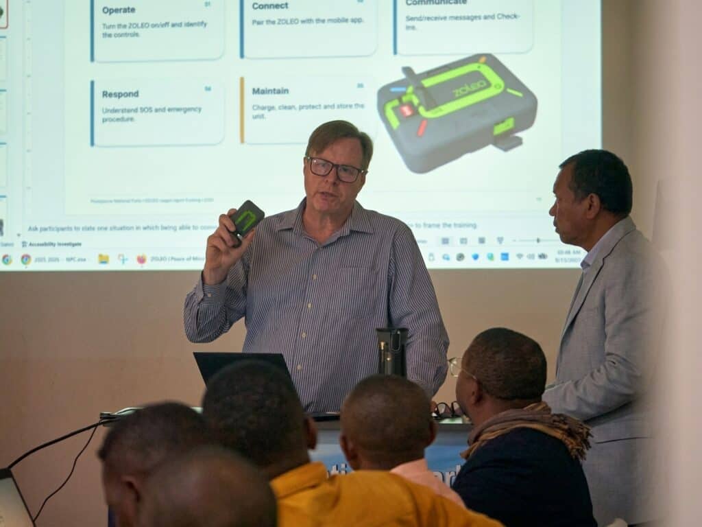
For the first time, Madagascar National Parks can see, coordinate, and respond to threats across its 8.3 million-acre Protected Area network through a National Protected Area Control Center. Protecting a forest begins with knowing what is happening inside it. In Madagascar, where Protected Areas span vast and often remote landscapes, that has always been a formidable challenge. This month, Madagascar National Parks (MNP) took an important step toward meeting that challenge with the inauguration and launch of Madagascar’s first National Protected Area Control Center in Antananarivo, supported by Conservation Allies. At the heart of the new center is SYNERGI-MNP, a national system designed to bring together information from Protected Areas, field teams and satellite-based environmental alerts, funded by Conservation Allies. Rather than information remaining isolated at individual sites, the Control Center provides MNP’s headquarters with a consolidated picture of incidents and conservation operations across the network, in real time. This represents a significant change in the way Protected Areas can be managed, from receiving information after the fact to now being able to identify emerging threats and support a rapid response in minutes. Previously, teams were already using Global Forest Watch, a satellite-based forest monitoring platform, to monitor fires and deforestation alerts, but monitoring and response were largely managed at the individual Protected Area level. Information was therefore spread across different teams and locations, making it more difficult to coordinate responses across the network. The new system brings these alerts and field updates together, helping teams verify threats, communicate more efficiently and respond more quickly. “This is a major step forward for Madagascar. SYNERGI-MNP allows us to connect what our teams are seeing in the field with real-time data from across our PA network, so that we can identify threats, verify what is happening and coordinate a response much more quickly. Most importantly, this technology strengthens our rangers—it gives them better information, better communication and greater security as they work to protect Madagascar’s forests and biodiversity.” — Dr. Ony Rakotoarisoa, Director General, Madagascar National Parks. From satellite alert to action SYNERGI-MNP incorporates real-time satellite alerts identifying forest fires and tree cover lost to deforestation, including in remote areas where monitoring is difficult. When a signal is received, it is checked by the MNP Control Center team. They then immediately communicate with the Protected Area managers and patrol staff to understand what is happening, determine its significance, and coordinate a response. By enabling MNP to detect threats earlier and coordinate faster responses to fires, logging and agricultural expansion, the system is expected to help reduce deforestation across Madagascar’s Protected Area network. Connecting the rangers protecting Madagascar’s forests As part of the initiative, MNP is deploying 100 ZOLEO satellite communicators donated by Conservation Allies and ZOLEO to strengthen communication between remote Protected Areas and headquarters. The devices allow teams to communicate where conventional networks are not available, share their location constantly, conduct safety check-ins, and send SOS alerts in an emergency. The initiative also includes 66 smartphones equipped to support field operations, including SMART patrol tracking and the transmission of information from teams working in the field. Together, these tools help connect rangers and patrol teams in some of Madagascar’s most remote landscapes with the national coordination system. “Conservation is ultimately about people taking action to protect nature. Our goal in supporting SYNERGI-MNP, the Control Center and the ZOLEO communications network is to give Madagascar’s rangers and conservation managers the information and tools they need to act faster and more effectively. This is much more than a technology project—it is building a national conservation intelligence system that can help ensure that when a threat is detected, someone knows about it, knows what to do, and can respond.” — Dr. Paul Salaman, President, Conservation Allies. From technology to a culture of rapid response A control center cannot protect a forest simply by displaying an alert on a screen. Someone must respond, and the outcome must be recorded. That is why SYNERGI-MNP is establishing clear operational procedures and responsibilities for field teams, Protected Area focal points, park directors, and headquarters staff. The project’s ambitious performance targets include 100% of critical incidents transmitted within 10 minutes and at least 80% treated within 24 hours. These targets create something that conservation management has often lacked: measurable standards for how quickly information moves from detection to action. They also provide a way to learn. By tracking incidents, response times and outcomes, MNP can identify where the system is working, where bottlenecks remain and how procedures can be improved. For Madagascar, this is an important moment The country’s Protected Areas face enormous and growing pressures—from forest fires and deforestation to illegal activities and the challenges of operating in remote landscapes. By connecting the rangers on the ground with better information, reliable communications and a national coordination system, Madagascar is building the ability to see threats sooner, understand them faster and respond more effectively. This is not simply a new way to monitor Madagascar’s forests. It is a new way to protect them. The initiative is led by Madagascar National Parks and the Ministry of Environment and Sustainable Development, with support from the Government of Germany through BMZ and KfW, the Fondation pour les Aires Protégées et la Biodiversité de Madagascar (FAPBM), and Conservation Allies, whose support helped establish the Control Room and strengthen the associated operational infrastructure. We also thank Zoleo for supporting this initiative.
Remembering Mahery Rakotobe

The entire Conservation Allies team is heartbroken by the tragic loss of our colleague and friend, Mahery Rakotobe, who was killed on Monday, August 24, in Madagascar. Mahery served as Conservation Allies’ Madagascar Conservation Communications Officer in Madagascar, where he brought his country’s spectacular nature, wildlife, and the people working to protect it, to audiences around the world. Mahery was a talented storyteller with a career that extended well beyond his work with Conservation Allies. A skilled videographer, video editor, producer, and entrepreneur, he worked through his own production studio, RM STUDIO MG, creating visual stories and bringing to life a range of organizations and projects in Madagascar. Mahery understood the power of visual storytelling. He knew that a photograph or a few minutes of video could help someone thousands of miles away understand why Madagascar’s forests and wildlife matter, and why protecting them is so important. Through his work, he helped give Malagasy conservation a voice and protect his country for future generations. Beyond his professional accomplishments, Mahery was a devoted husband and father. He leaves behind his wife and their two-year-old twin sons, who were at the center of his life. We are deeply grateful for the time we had with Mahery, for everything he gave to conservation, and for the stories he helped bring to the world. Our thoughts and deepest condolences are with his family, friends, colleagues, and everyone who knew and loved him. Mahery will be deeply missed, but his work and his stories will continue to inspire us.
Keeping Madagascar’s Lemurs Connected: Protecting the COFAV Corridor
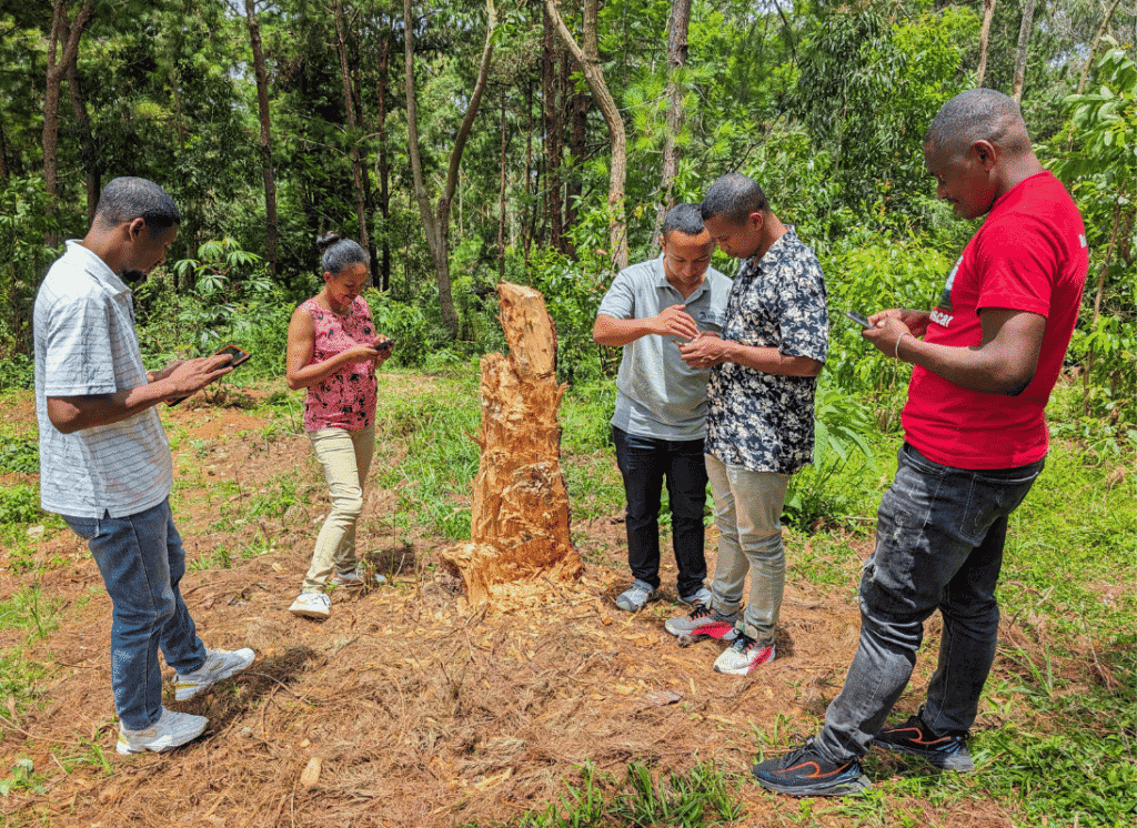
At least 16 species of lemur live inside a single ribbon of forest running down Madagascar’s eastern escarpment. Five of them are Critically Endangered. All of them depend on the same thing: that the ribbon doesn’t break. The Corridor Forestier Ambositra–Vondrozo—COFAV for short—stretches more than 776,000 acres across four regions and ten communes of Madagascar’s eastern escarpment. It is one of the country’s most biologically important Protected Areas, and one of the most strategically positioned: it links forest blocks that would otherwise be isolated islands, keeping the corridor’s wide-ranging species connected to enough habitat to survive. A Refuge for Madagascar’s Rarest Lemurs COFAV is one of the last places on Earth where the Critically Endangered Greater bamboo lemur still hangs on. The species depends on bamboo-rich rainforest that exists in only a handful of remaining strongholds, and the corridor is one of them. Alongside it live four other Critically Endangered lemurs, all dependent on the kind of connected, intact forest COFAV provides. For wide-ranging primates, connectivity is not a luxury. It is what allows populations to find mates, migrate as conditions change, and remain viable over time. Lose the corridor and you lose connectivity for half a dozen species the world won’t get back. Strengthening Protection on the Ground In April 2026, Conservation Allies funded a strategic coordination meeting in Manakara that brought together every institution responsible for protecting COFAV. Around the table were the Fitovinany Region, Ikongo District, the Manakara court, the gendarmerie and military, mayors of the surrounding communes, VOI (local community management) representatives, and the NGOs operating inside the corridor. The result was a shared operational plan for COFAV’s Conservation Brigades: faster authorizations from the regional environment office, clearer responsibilities across agencies, and a tighter commitment from law enforcement to mobilize quickly when conservation patrols need backup. Coordinated like this, the brigades can respond to illegal activity in time to actually stop it. Two Local Partners, Continuous Coverage Conservation Allies is directly supporting two local conservation organizations operating inside COFAV: Ny Tanintsika and the Miaradia Association. With both teams active across the corridor, patrol coverage is now continuous across the entire Protected Area—no single team has to carry the whole landscape on its own. That continuity matters. Illegal clearing tends to happen in the gaps between patrols. Closing those gaps—with local teams on the ground and law enforcement aligned behind them—is what gives the corridor’s lemurs the breathing room their populations need to recover. Why It Matters COFAV is not the kind of place most donors will ever visit. It doesn’t have the cinematic profile of Madagascar’s rainforests on the tourist circuit. But by almost any biological measure, it is irreplaceable—a refuge for some of the most endangered primates in the world, held together by the protected status of a single connected forest landscape. With direct support flowing to local partners on the ground, law enforcement coordinated with conservation patrols, and an operational plan that connects every institution responsible for the corridor’s future, COFAV’s protection is more robust now than it was a year ago. The work to keep it intact—patrol routes, permits, prosecutions, monitoring—is exactly the kind of work that determines whether a forest still exists in 2030.
Kawsay Biological Station Earns Protective status
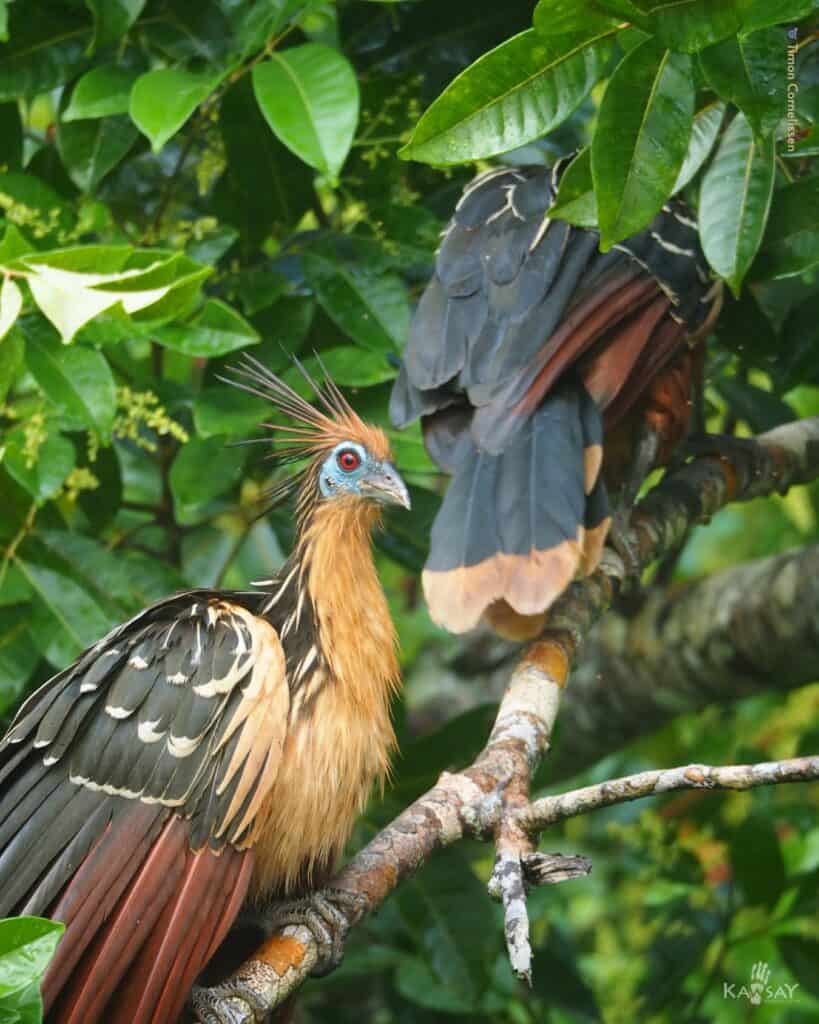
After a long evaluation by Peru’s Ministry of the Environment, Conservation Allies’ partner Kawsay Biological Station has been formally recognized as an Other Effective area-based Conservation Measure (OECM)—a designation that places its 437-acre reserve on the global registry of lands recognized for delivering meaningful conservation outcomes. “This year, after a long evaluation process by the Peruvian Ministry of the Environment, our area has been recognized as an OECM,” Kawsay’s team shared. “It reflects our recognition of the area’s inherent value and the management we’ve put in place to protect it, confirming our commitment to conservation and supporting the 30×30 target.” Why The Designation Matters For decades, the world’s Protected Area system has been measured almost entirely by national parks and government reserves. The OECM framework, developed under the Convention on Biological Diversity, broadens that picture to include private reserves, Indigenous and community-conserved lands, and other governance models that deliver effective conservation in practice—whether or not they fit the traditional definition of a Protected Area. The recognition also matters for something larger than any single reserve. The global 30×30 goal—the international commitment to safeguard at least 30% of the planet’s land and oceans by 2030—depends heavily on OECMs. Without them, no realistic accounting reaches 30%. With them, locally led reserves like Kawsay become part of the global conservation balance sheet. Kawsay is now listed on the World Database on Protected Areas, the international system used to track conservation coverage worldwide, and its outcomes will be monitored alongside thousands of other sites. For a small biological station in Peru working at the intersection of research, capacity building, and on-the-ground wildlife conservation, the designation is both a recognition and a commitment. It is one more piece of evidence that locally led conservation, properly resourced, can stand alongside the world’s most established protected landscapes.
How A Shuar Community Used Science To Keep Their Forest Standing
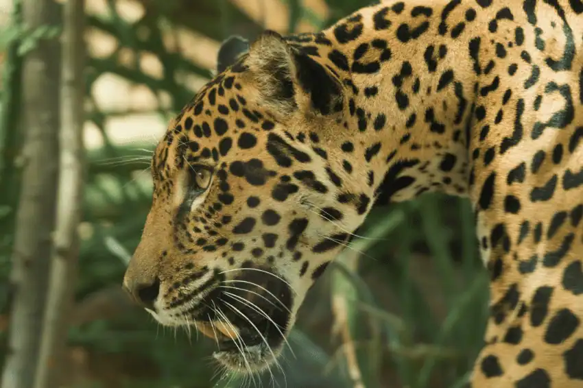
Three years ago, a Shuar Indigenous community in southern Ecuador set out to defend their forest with science. They now have the data to prove it worked. The Maikiuants, a Shuar community in the gold-mining frontier of Morona Santiago province, have spent the last three years working with Ecoforensic and the University of Azuay on a pilot project that paired Indigenous land governance with rigorous biological monitoring. Conservation Allies was a key funder of the work. As that project wraps up, the community’s paraecologists and their academic collaborators have arrived at a single quantitative finding that summarizes the rest: more than 80% of the Maikiuants’ territory remains in primary forest. In a region under constant pressure from expanding mining concessions, that number is not typical. It is what success looks like. What The Pilot Proved The framework was simple in concept and complex in execution. The community’s life plans—the locally authored documents that codify how Shuar territory is used, managed, and defended—provided the governance backbone. Trained paraecologists from inside the community ran the science: drone mapping, camera trap surveys, biodiversity assessments, and documentation of land-use change. Two graduate theses, including one from the University of Sussex, are now being developed into academic papers, and the work is positioned to anchor future Rights of Nature legal cases under Ecuador’s constitution. The takeaway, according to Ecoforensic’s founding director Mika Peck: when Indigenous governance and ecological evidence are built side by side, both grow stronger. The life plans direct what the science measures. The science makes the life plans defensible in court. A Research Center On The Way The most consequential outcome of the three-year pilot isn’t going onto a final report. It’s being put into action. In 2027, the Maikiuants and their partners will begin co-designing and building the Shuar Arutam Scientific and Cultural Center—a permanent research station inside the territory designed to host transdisciplinary work that bridges Indigenous knowledge and academic science. The Center is a significant step for the Shuar communities, opening new opportunities for higher education, cultural continuity, and long-term ecological research in one of the most understudied stretches of the western Amazon. Conservation Allies’ funding of the pilot phase made the transition to the new Center possible—the next three years will be shaped by the community and academic partners on the ground. What’s Next The immediate next step is smaller in scope, larger in implication. With Conservation Allies’ support, the Maikiuants are expanding a camera trap program across the territory: a rigorous baseline of population estimates for Jaguars and other large mammals, paired with documentation of incursions onto Shuar land. The conservation value of that data is obvious. The legal value may be larger. Under Ecuador’s constitutional Rights of Nature framework, ecosystems themselves can be represented in legal proceedings—but cases turn on evidence. A multi-year camera trap dataset showing a stable Jaguar population is admissible proof that the territory functions as a viable ecosystem, and that mining incursions are damaging something the constitution protects. Looking Ahead The political landscape in Ecuador has shifted, and the Maikiuants’ work is happening under conditions that are anything but stable. But the underlying model—community-authored life plans, paraecologist-led monitoring, university partnerships, and Rights of Nature litigation—is now too well-evidenced to dismiss. The first three years answered the question of whether it works. The next three will determine how far it scales.
Madagascar Releases Landmark Scientific Roadmap to Protect Its Wildlife
Madagascar’s Ministry of Environment and Sustainable Development (MEDD) is releasing the findings of a landmark scientific workshop that will guide the country’s ambitious plan to create new Protected Areas – an effort supported by Conservation Allies, Re:wild, Hempel Foundation, Rainforest Trust, and Campaign for Nature. In late March 2026, 70 participants – including 50 scientists representing seven major taxonomic groups, 70% of them Malagasy – completed the country’s first comprehensive scientific re-prioritization of terrestrial biodiversity since 1995. The result is a consensus map covering roughly 44.5 million acres of priority land—about one-third of Madagascar—providing government, conservation organizations, communities, and funders with a shared scientific foundation for determining what to protect and where to act first. Within that area, the workshop identified priority zones for new and expanded Protected Areas, ecological corridors to reconnect fragmented landscapes, and for the first time, freshwater ecosystems critical for water security and biodiversity. Madagascar covers just 0.4% of the world’s land surface but harbors approximately 5% of all species on Earth, more than 90% of which occur nowhere else. One acre of forest lost in Madagascar has a greater impact on global biodiversity than almost anywhere on the planet. The last time scientists systematically mapped where protection was most needed was in 1995. Thirty-one years later, scientific knowledge has advanced dramatically while pressures on biodiversity have intensified, making this moment both overdue and urgent. “Madagascar has demonstrated extraordinary leadership by moving from commitment to implementation,” said Dr. Paul Salaman, President of Conservation Allies. “This workshop brought together the country’s leading scientists to answer a fundamental question: where should we focus our efforts to secure the greatest conservation impact? The result is the most comprehensive scientific roadmap for terrestrial biodiversity conservation ever produced for Madagascar, and it gives government, communities, NGOs, and donors a common blueprint for action.” “In my years working in Madagascar, I have never seen an exercise of this scale or rigor,” said Professor Lily Arison Rene de Roland, lead scientist for the bird group at the workshop. “The gaps we identified are just as important as the sites themselves. They are an honest map of where the next discoveries are waiting to be made.” “What stood out to me from the workshop was not just the science, but who was doing it,” said Dr. Steven Goodman, MacArthur Field Biologist at Chicago’s Field Museum of Natural History and Association Vahatra. “A generation of Malagasy scientists now leads this work, building on decades of international collaboration to produce something that is genuinely their own. That transition in scientific leadership is as significant as the findings in this report.” In February 2026, the Government of Madagascar designated 21 new Protected Areas covering 4.5 million acres, bringing the national Protected Area network to 22 million acres. In April 2026, Prime Minister Mamitiana Rajaonarison formally reaffirmed his government’s commitment to the 30×30 Biodiversity Plan – a global goal to protect 30% of the planet by 2030. Through periods of political uncertainty, Madagascar’s commitment to this work has remained steadfast. “For the first time in more than three decades, we know exactly where to focus our efforts to save Madagascar’s terrestrial biodiversity,” said Alain Liva Raharijaona, 30×30 Coordinator at MEDD. “This workshop has given us that clarity, grounded in the best available science and collectively owned by Madagascar. Now we act on it.” The findings now feed directly into implementation. The highest-confidence priority areas will be fast-tracked for protection over the next two years, while targeted biological surveys begin filling knowledge gaps that will guide conservation action throughout the remainder of the decade. The workshop was convened and organized by Conservation Allies in partnership with Madagascar’s Ministry of Environment and Sustainable Development (MEDD), with financial support from Conservation Allies, Re:wild, Hempel Foundation, Rainforest Trust, and Campaign for Nature.